Posts Tagged ‘size’
“The world of reality has its limits; the world of imagination is boundless”*…
… and the digital world? Maybe, as Rob Beschizza reports, somewhere in between…
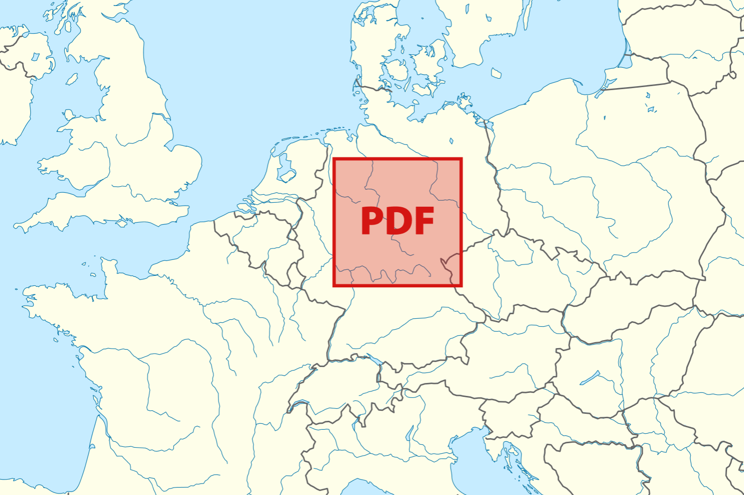
Alex set out to debunk the given wisdom that the maximum dimensions of a PDF are 381 km2, which is smaller than Germany. She presents her conclusions in an article titled “Making a PDF that’s larger than Germany,” so you know from the outset she succeeded. It’s a fascinating example of the disalignment of specifications, implementations, and reality. You can make one by hacking the postscript, and while Adobe Acrobat won’t like it, other apps will…
Borges would be delighted…
“On exactitude in PDFs“
Just how big was Alex [Chan] able to make her PDF?…
… unlike Acrobat, the Preview app doesn’t have an upper limit on what we can put in MediaBox. It’s perfectly happy for me to write a width which is a 1 followed by twelve 0s…
If you’re curious, that width is approximately the distance between the Earth and the Moon. I’d have to get my ruler to check, but I’m pretty sure that’s larger than Germany.
I could keep going. And I did. Eventually I ended up with a PDF that Preview claimed is larger than the entire universe – approximately 37 trillion light years square. Admittedly it’s mostly empty space, but so is the universe. If you’d like to play with that PDF, you can get it here.
Please don’t try to print it.
“Making a PDF that’s larger than Germany“
* Jean-Jacques Rousseau
###
As we scale up, we might spare a thought for Émile Borel; he died on this date in 1956. A mathematician (and politician who served as French Minister of the Navy), he is remembered for his foundational work in measure theory and probability. He published a number of research papers on game theory and was the first to define games of strategy.
But Borel may be best remembered for a thought experiment he introduced in one of his books, proposing that a[n immortal] monkey hitting keys at random on a typewriter keyboard will – with absolute certainty – eventually type every book in France’s Bibliothèque Nationale de France. This is now popularly known as the infinite monkey theorem.

“Nothing can better cure the anthropocentrism that is the author of all our ills than to cast ourselves into the physics of the infinitely large (or the infinitely small)”*…

And very eye-opening it can be. Jason Kottke reports on an article in the most recent issue of the American Journal of Physics with the understated title of “All objects and some questions.”
You just have to admire a chart that casually purports to show every single thing in the Universe in one simple 2D plot. [As the article’s author explain:]
In Fig. 2 [above], we plot all the composite objects in the Universe: protons, atoms, life forms, asteroids, moons, planets, stars, galaxies, galaxy clusters, giant voids, and the Universe itself. Humans are represented by a mass of 70 kg and a radius of 50 cm (we assume sphericity), while whales are represented by a mass of 10^5 kg and a radius of 7 m.
The “sub-Planckian unknown” and “forbidden by gravity” sections of the chart makes the “quantum uncertainty” section seem downright normal — the paper collectively calls these “unphysical regions.” Lovely turns of phrase all.
But what does it all mean? My physics is too rusty to say, but I thought one of the authors’ conjectures was particularly intriguing: “Our plot of all objects also seems to suggest that the Universe is a black hole.”…
Is the universe a black hole? (and other provocative propositions): @kottke on a recent scientific paper: “The Plot of All Objects in the Universe.”
* Julio Cortázar, Around the Day in Eighty Worlds
###
As we size up scale, we might recall that it was on this date in 451 that a different kind of attempt to reconcile the finite and the infinite began: the first session of the Council of Chalcedon (in modern-day Turkey) was opened. The fourth ecumenical council of the Christian church, it was attended by over 520 bishops or their representatives (making it the largest and best documented of the first seven ecumenical councils). It was convened by the Roman emperor Marcian to re-assert the teachings of the ecumenical Council of Ephesus against the heresies of Eutyches and Nestorius— whose teachings attempted to dismantle and separate Christ’s divine nature from his humanity (Nestorianism) and further, to limit Christ as solely divine in nature (Monophysitism).
The Council succeeded in that task. As Jaroslav Pelikan characterized their findings:
We all teach harmoniously [that he is] the same perfect in godhead, the same perfect in manhood, truly God and truly man, the same of a reasonable soul and body; homoousios with the Father in godhead, and the same homoousios with us in manhood … acknowledged in two natures without confusion, without change, without division, without separation.
… which marked a turning point in the Christological debates. But it also generated heated disagreements between the council and the Oriental Orthodox Church, which saw things differently– a contention that informed the separation of the Oriental Orthodox Churches from the rest of Christianity… and led to the Council being remembered as “Chalcedon, the Ominous.”

“There is a limit to thinking about even a small piece of something monumental”*…
Still, we can try…

Via Jason Kottke, who is reminded…
of Ben Terrett’s calculation of how many helveticas from here to the Moon and my subsequent calculations about the point size of the Earth and the Moon (50.2 billion and 13.7 billion, respectively).
* Jeff VanderMeer, Annihilation
As we size up scale, we might recall that it was on this date (the feast day of St. Mary Magdalene) in 1342, that Central Europe’s worst flood ever occurred. Following the passage of a Genoa low, the rivers Rhine, Moselle, Main, Danube, Weser, Werra, Unstrut, Elbe, Vltava, and their tributaries inundated large areas. Many towns such as Cologne, Mainz, Frankfurt am Main, Würzburg, Regensburg, Passau, and Vienna were seriously damaged, with water levels exceeding those of the 2002 European floods. Even the river Eider north of Hamburg flooded the surrounding land; indeed, the affected area extended to Carinthia and northern Italy.

“Being so many different sizes in a day is very confusing”*…

Maps are crucial– and they’re also often crucially wrong… or at least misleading. Any attempt to reduce our 3-D world in 2-D results in distortion.
It is hard to represent our spherical world on flat piece of paper. Cartographers use something called a “projection” to morph the globe into 2D map. The most popular of these is the Mercator projection.
Every map projection introduces distortion, and each has its own set of problems. One of the most common criticisms of the Mercator map is that it exaggerates the size of countries nearer the poles (US, Russia, Europe), while downplaying the size of those near the equator (the African Continent). On the Mercator projection Greenland appears to be roughly the same size as Africa. In reality, Greenland is 0.8 million sq. miles and Africa is 11.6 million sq. miles, nearly 14 and a half times larger.
This app was created by James Talmage and Damon Maneice. It was inspired by an episode of The West Wing and an infographic by Kai Krause entitled “The True Size of Africa“. We hope teachers will use it to show their students just how big the world actually is…
The world as it actually is: “The True Size,” an interactive tool that let’s one compare the real scale of any two countries.
Apposite: “Animated Map: Where Are the Largest Cities Throughout History?” (with thanks to friend JA)
* Lewis Carroll, Alice’s Adventures in Wonderland
###
As we muse on measurement, we might recall that it was on this date in 1513 that Spanish explorer Juan Ponce de Leon came ashore and claimed “La Florida” [the “land of flowers”] for Spain. While it has long been accepted that de Leon landed with his three caravels near St. Augustine and became the first European of record to see the peninsula, scholars have recently challenged details of that historical account, suggesting that he actually beached near Melbourne.
In any event, he went on to map the Atlantic coast down to the Florida Keys and north along the Gulf coast; historian John Reed Swanton believed that he sailed perhaps as far as Apalachee Bay on Florida’s western coast. Though popular lore has it that he was searching for the Fountain of Youth, there is no contemporary evidence to support the story, which most modern historians consider a myth.

“It’s not the size of the nose that matters, it’s what’s inside that counts”*…

Dimensions.com is an ongoing reference database of dimensioned drawings documenting the standard measurements and sizes of the everyday objects and spaces that make up our world. Created as a universal resource to better communicate the basic properties, systems, and logics of our built environment, Dimensions.com is a free platform for increasing public and professional knowledge of life and design…
Dimensions.com is an ongoing public research project founded by architect Bryan Maddock and continues to be developed through the architecture practice Fantastic Offense.
The measure of man’s manufacture: Dimensions.com
(See also “Not too big, not too small… just right” for an earlier look at a similar initiative…)
* Steve Martin
###
As we realize that the ruler rules, we might it was on this date in 1951 that the first long distance direct dial call was made (from Englewood, New Jersey, to Alameda, California) in the U.S.– area codes became a reality. The North American Numbering Plan had been published in 1947, dividing most of North America into eighty-six numbering plan areas (NPAs). Each NPA was assigned a unique three-digit code, typically called NPA code or simply area code. These codes were first used by long-distance operators in establishing long-distance calls between toll offices. By the early 1960s, most areas of the Bell System had been converted and DDD had become commonplace in cities and most towns in the United States and Canada. By 1967, the number of assigned area codes had grown to 129. There are currently 317 geographic area codes in the United States and an additional 18 non-geographic area codes, totaling 335 US area codes.

You must be logged in to post a comment.