Posts Tagged ‘earth’
“The moon is a friend for the lonesome to talk to”*…

… and, as Bartosz Ciechanowski explains in a stunningly-illustrated essay, so much more. The moon affects our tides, our light, and even the Earth’s rotation– it’s no wonder that our constant companion has so haunted human culture…
… The Moon may be just an unassuming neighbor in the sky, but its presence affects our lives in many subtle ways. When it reflects sunlight off its scarred surface to guide the way in the darkness of night, or as it breathes life into oceans by rhythmically raising tides, or when it cloaks the Sun in a rare and awe-inspiring total solar eclipse, the Moon reminds us of the celestial world right outside of the safe confines of our planet.
Traveling through the cold and empty space by Earth’s side, the Moon is always just there. It may be barren and dull, but, undeterred by its own lifelessness, it never leaves us completely alone.
Perhaps the next time you catch a glimpse of the Moon’s shiny surface beaming in the night sky, you’ll see it a little differently – not as a mundane fixture of the heavens, but as a fellow companion that gently affects our own existence…
Absolutely fascinating– and beautiful: “Moon,” from @bciechanowski.bsky.social. Via @TheBrowser.
This is (R)D‘s second visit with Ciechanowski, who earlier helped us understand “Sound”; for more of his extraordinary work, visit his archive.
More on the moon and here.
* Carl Sandburg
###
As we raise our eyes, we might send celestial birthday greetings to William Wilson Morgan; he was born on this date in 1906. As astronomer and astrophysicist, he was professor and astronomy director for the University of Chicago’s Yerkes Observatory in Wisconsin and managing editor of Astrophysical Journal. He was a leader in stellar and galaxy classification and helped prove the existence of spiral arms in our galaxy.

“Some say the world will end in fire, some say in ice.”*…

Ethan Siegel reminds us that the world– the living world– almost did end in ice…
… one event came closer than any other to bringing an end to life on Earth: a catastrophe known as either the Great Oxidation Event or the Great Oxygenation Event. Oxygen, one of the hallmark characteristics of our living Earth, was a tremendous destructive force when it first arrived in any sort of meaningful abundance some ~2 billion years after Earth first took shape. The slow alteration of our atmosphere by the gradual addition of oxygen proved to be fatal to the most common types of organism that were present on Earth at the time. For several hundred million years, the Earth entered a horrific ice age which froze the entire surface: known today as a Snowball Earth scenario. This disaster almost ended life on Earth entirely. Here’s the story of our planet’s near-death, culminating in life’s ultimate survival story…
For roughly 300 million years, the Earth was frozen: “What was it like when oxygen killed almost all life on Earth?” from @StartsWithABang in @bigthink. Eminently worth reading in full.
* Robert Frost, “Fire and Ice“
###
As we contemplate change, we might send chilly birthday greetings to Raoul Pictet; he was born on this date in 1846. Remembered as a pioneer in cryogenics, Pictet was a Swiss chemist who spent much of his career trying to produce very low temperatures (in order to produce ice for refrigeration)– which led him to the creation of liquid oxygen in 1877 (for which he’s credited as co-discoverer, as French scientist Louis-Paul Cailletet, working completely separately, also produced liquid oxygen that year).

“You may delay, but time will not”*…
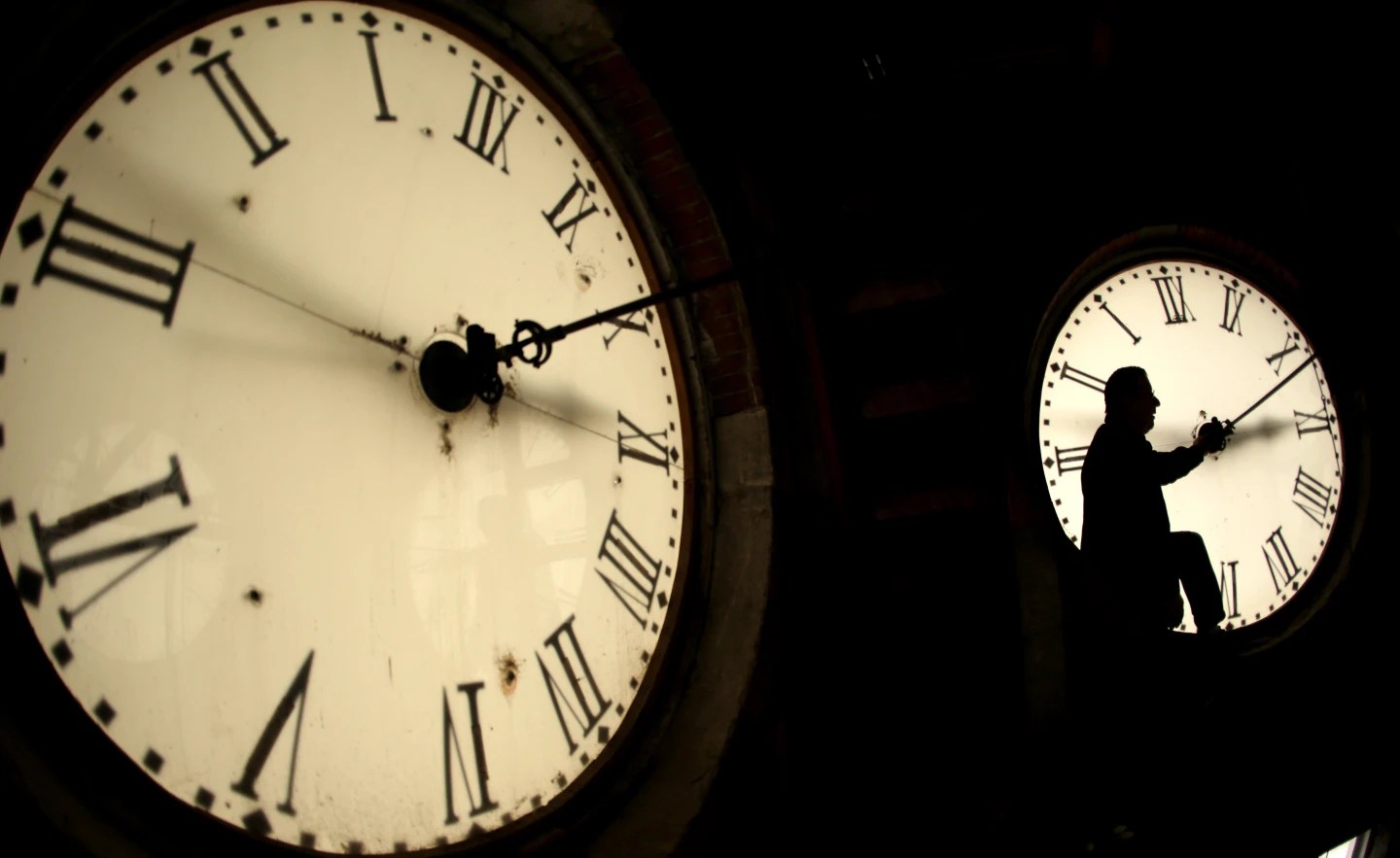
It turns out that our feeling that things are speeding up has some basis in science…
Earth’s changing spin is threatening to toy with our sense of time, clocks and computerized society in an unprecedented way — but only for a second.
For the first time in history, world timekeepers may have to consider subtracting a second from our clocks in a few years because the planet is rotating a tad faster than it used to. Clocks may have to skip a second — called a “negative leap second” — around 2029, a study in the journal Nature said Wednesday.
“This is an unprecedented situation and a big deal,” said study lead author Duncan Agnew, a geophysicist at the Scripps Institution of Oceanography at the University of California, San Diego. “It’s not a huge change in the Earth’s rotation that’s going to lead to some catastrophe or anything, but it is something notable. It’s yet another indication that we’re in a very unusual time.”
Ice melting at both of Earth’s poles has been counteracting the planet’s burst of speed and is likely to have delayed this global second of reckoning by about three years, Agnew said.
“We are headed toward a negative leap second,” said Dennis McCarthy, retired director of time for the U.S. Naval Observatory who wasn’t part of the study. “It’s a matter of when.”…
The full story: “A faster spinning Earth may cause timekeepers to subtract a second from world clocks,” from @AP.
For (even) more on leap seconds on their history, see “Will We Have a Negative Leap Second?“, by Demetrios Matsakis (also a retired director of time for the U.S. Naval Observatory).
See also: “Climate change is altering Earth’s rotation enough to mess with our clocks” (gift article): “in that one second, the Earth rotated about four football fields”
* Benjamin Franklin
###
As we muse on measurement, we might send carefully-observed birthday greetings to Sir Harold Spencer Jones; he was born on this date in 1890. An astronomer (indeed, for 23 years the tenth Astronomer Royal), he specialized in positional astronomy, particularly the motion and orientation of the Earth in space… a focus that helped him contribute to knowledge of the Earth’s rotation and improved timekeeping– efforts that led to Spencer Jones’ election (in 1947) as the first President of the Royal Institute of Navigation (which, In 1951, named its highest award, the Gold Medal, in his honor).

“If you want to understand today you have to search yesterday”*…

… and for your searching pleasure here are all of our yesterdays, in an animation scrolling by at 1.5 million years per second…
Earth is 4.5 billion years old – which is approximately the same amount of time it took us to create this video. We’ve scaled the complete timeline of our Earth’s life into our first animated movie!… Hop on a musical train ride and experience how long a billion years really is. It’s the perfect background for your next party, a great way to take a break from studying, or a fascinating companion while you’re on the go…
From German animation house Kurzgesagt (“in a nutshell”)…
Posters here.
* Pearl Buck
###
As we trace our steps, we might recall that it was on this date in 1913 that Gulf Refining Company opened the first “drive-in filling station” in Pittsburgh. It was the first architect-designed station and the first to distribute free road maps; it also offered tube and tire installation, free water and air, and crankcase services.

“There is a limit to thinking about even a small piece of something monumental”*…
Still, we can try…

Via Jason Kottke, who is reminded…
of Ben Terrett’s calculation of how many helveticas from here to the Moon and my subsequent calculations about the point size of the Earth and the Moon (50.2 billion and 13.7 billion, respectively).
* Jeff VanderMeer, Annihilation
As we size up scale, we might recall that it was on this date (the feast day of St. Mary Magdalene) in 1342, that Central Europe’s worst flood ever occurred. Following the passage of a Genoa low, the rivers Rhine, Moselle, Main, Danube, Weser, Werra, Unstrut, Elbe, Vltava, and their tributaries inundated large areas. Many towns such as Cologne, Mainz, Frankfurt am Main, Würzburg, Regensburg, Passau, and Vienna were seriously damaged, with water levels exceeding those of the 2002 European floods. Even the river Eider north of Hamburg flooded the surrounding land; indeed, the affected area extended to Carinthia and northern Italy.

You must be logged in to post a comment.