Posts Tagged ‘navigation’
“Unlimited tolerance must lead to the disappearance of tolerance”*…

In 1945, in The Open Society and Its Enemies, Karl Popper described “the paradox of tolerance“…
The so-called paradox of freedom is the argument that freedom in the sense of absence of any constraining control must lead to very great restraint, since it makes the bully free to enslave the meek. The idea is, in a slightly different form, and with very different tendency, clearly expressed in Plato.
Less well known is the paradox of tolerance: Unlimited tolerance must lead to the disappearance of tolerance. If we extend unlimited tolerance even to those who are intolerant, if we are not prepared to defend a tolerant society against the onslaught of the intolerant, then the tolerant will be destroyed, and tolerance with them. — In this formulation, I do not imply, for instance, that we should always suppress the utterance of intolerant philosophies; as long as we can counter them by rational argument and keep them in check by public opinion, suppression would certainly be unwise. But we should claim the right to suppress them if necessary even by force; for it may easily turn out that they are not prepared to meet us on the level of rational argument, but begin by denouncing all argument; they may forbid their followers to listen to rational argument, because it is deceptive, and teach them to answer arguments by the use of their fists or pistols. We should therefore claim, in the name of tolerance, the right not to tolerate the intolerant. We should claim that any movement preaching intolerance places itself outside the law, and we should consider incitement to intolerance and persecution as criminal, in the same way as we should consider incitement to murder, or to kidnapping, or to the revival of the slave trade, as criminal…
Mark Manson offers a critique…
… Popper proposed the Paradox of Tolerance to explain why a German public full of otherwise good people allowed Hitler to come to power and commit so many atrocities. Since then, the Paradox of Tolerance has survived and has occasionally become a talking point in discussions about social justice. The idea is that it’s okay to be a piece of shit to someone because they, too, are a piece of shit.
But the problem is that, most of the time, it’s not crystal clear what defines “tolerance” and “intolerance.”… Like most thought experiments inspired by Hitler, it doesn’t really work when you don’t have someone who is so obviously evil to unite against. As a result, the definition of an intolerant person has become so muddied and loose to the point where it might as well mean, “someone who believes things that make me feel bad.”…
The problem with Popper’s reasoning is that it quickly devolves into a cascade of dickish, self-righteous behavior.
Let’s say Person B decides that Person A’s behavior is intolerant and a threat to society. Person B then decides that it is morally correct to be intolerant of Person A and treat her like crap.
But then, Person C strolls by and notices Person B being a totally intolerant assface to Person A. Person C then decides that it’s morally correct to be actively intolerant of Person B. But then Person D strolls by, and notices Person C being horribly intolerant towards Person B…
You can see where this is going. And if you ever doubt the realism of this scenario, I invite you to spend a few hours on Twitter some time.
The irony is that in order to practice tolerance, you must be willing to sit with things that upset you or make you uncomfortable.
Yet, if your adopted ethic is that no one should ever be upset or uncomfortable, then you make any sort of tolerance impossible…
– source
I imagine that Popper might respond first that, of course, Manson is right that the definition of intolerance is slippery and that most varieties of unshared disapproval are best tolerated– indeed, that’s the essence of an open society.
But I suspect that he’d further argue that it is possible, well shy of Hitlerian extremes, to identify the intent (beyond disapproving) to debar– to abridge the fundamental rights of others. Even then, of course, it’s tricky– especially in social/cultural periods in which xenophobia and othering are in the ascendant, when difference isn’t perceived to be simply difference or disagreement, but a threat.
Still (presuming again to channel Popper), if one values an open society, one must practice the art (which is to say that it’s not a science) of protecting against this extreme, imperious intolerance– lest it squelch all alternatives to itself. This was the challenge taken up by the Founding Fathers in crafting the U.S. Constitution. And as they observed (but we tend to forget) it’s an on-going challenge. They imagined that the Constitution would be continually revised, both to reflect “learning” (what worked and what didn’t– practical learning) and to reflect changing circumstances and culture (the social and cultural learning/development on which, as Humanists, they were counting).
It’s hard… but then, as my old man used to say, that’s why they call it a paradox…
* Karl Popper
With apologies, another “hiatus notice”: I’m headed into three days of very intense meetings, so (R)D will be off until Friday…
###
As we deal with dichotomies, we might spare a cartographically-constructive thought for one of history’s most impactful scientific artists: Gerardus Mercator; he died on this date in 1594. The most renown cartographer of his time, he created a world map based on a new projection– the Mercator Projection— on which parallels and meridians are rendered as straight lines spaced so as to produce at any point an accurate ratio of latitude to longitude and sailing courses of constant bearing are represented as straight lines, an approach still employed in nautical charts used for navigation. He also introduced the term “atlas” for a collection of maps.
While he is most esteemed as the foremost geographer of his day, Mercator was also an accomplished engraver, calligrapher and maker of globes and scientific instruments. And he studied theology, philosophy, history, mathematics, and magnetism.

“Curiosity has its own reason for existing”*…

Brian Klaas on how it is we know where we are– a riff from his recent book, Fluke: Chance, Chaos, and Why Everything We Do Matters that covers everything from navigational neurons to the calculation of longitude (with helpful updates to Dava Sobel’s estimable account)– and on how that history demonstrates the importance of curiosity…
We now navigate the world with ease, our location pinpointed by satellites floating high above us in the heavens, but it was not always so. How have our brains evolved to explore a complex landscape? And how did an 18th century government harness the dreams of crackpots and obsessive craftsmen to solve one of the most important questions of them all: where am I? The answer lies with an extraordinary story, linking neurons with naval history…
[Klass illustrates the cost of bad navigation [naval disasters], explains how animals [including humans] use “magnetic maps to navigate by a kind of dead reckoning], and unpacks the many obstacles to determining longitude at sea [mainly that it depended on very accurate time-keeping, a problem at sea with current clocks. The British Parliament offered a monumental cash prize for solving the conundrum, but there were no winners… until John Harrison came along…]
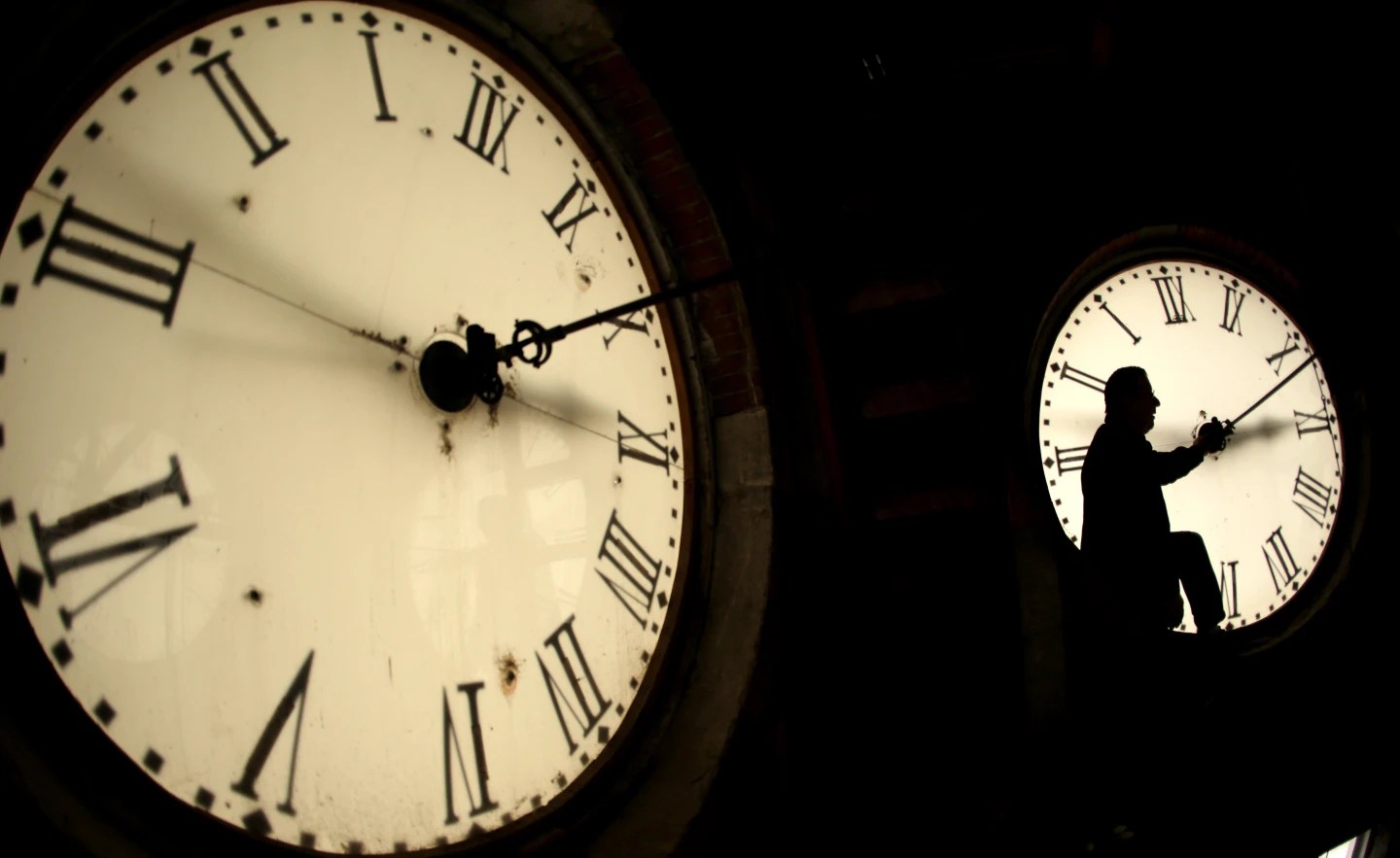
… John Harrison changed everything.
Harrison had little formal education, but was masterful working with wood and was fascinated by clocks. At first, he had difficulty convincing the scientific establishment of his ideas, but soon, his clocks dazzled. He refined them over decades—in one case spending seventeen years working on a single clock—producing five timepieces, the first working marine chronometers. Little by little, they improved, making it plain that scientific impossibility was becoming reality, forged through the determination and inventiveness of a self-taught craftsmen with a laudable obsession with problem-solving and timekeeping.
Harrision came up with several innovations that changed not just marine history, but world history. His clocks solved the problem of oil by designing it away; his timepieces—seemingly miraculously—employed several new anti-friction devices, facilitated by, among other innovations, using a naturally oily wood. Then, taking his genius one step further, Harrison invented the caged roller bearing, a nearly frictionless mechanism that later helped unleash the industrial revolution by improving machinery. Caged roller bearings are still used in “virtually every complex machine made today.”
To solve the problem of pendulums that elongate or shrink in varied climates, Harrison invented a bimetallic mechanism of canceling these expansions and contractions out. By combining brass and steel, he could effectively ensure that any bit of the mechanism that elongated would be offset as “the downward expansion of the steel rods is counteracted by the upward expansion of the brass rods.” Harrison’s related invention of the bimetallic strip is still used today and has been instrumental in thermometers, gas safety valves in ovens, electric circuit breakers, and cars, to name a few…
…
… For centuries, Harrison’s innovations changed history, and revolutionized navigation on the seas. That only changed in the early 20th century, when the wireless telegraph and radio signals made it possible to transmit time signals across vast distances to shipboard receivers. Finally, GPS—using satellites—eclipsed methods that relied on earthbound timekeeping.
But the tale of longitude—and the ongoing scientific sleuthing into the neurons we use to navigate across shorter distances—yield three important lessons.
First, government prizes can act as a crucial catalyst for scientific innovation. The industrial revolution and the rise of British naval superiority were both partially unleashed due to an investment of just two million pounds in today’s value [the prize offered by Parlaiment]. We should be developing many more state-funded scientific prizes today, particularly for research into neuroscience, as the 21st century will likely be defined by our understanding of complex cognition, both artificial and human.
Second, scientific snobbery—and excluding people from innovation based on credentialism—could have kept Harrison’s ideas from emerging, delaying crucial progress. It’s a cautionary tale for the modern world, in which our degrees are often wrongly imagined as an accurate shorthand for our intellectual worth.
Finally, the tale of longitude highlights the intellectual incuriosity of our modern age, in which we, to an unprecedented degree, drift through the world while rarely pausing to ask “how does that work?” We happily tap our destination into Google Maps, never wondering how the solution to what is now such a banal task as navigation changed the fate of the world forever.
In one wonderful psychology study, participants were asked if they knew how a toilet worked. “Of course!” the participants replied. “Great!” said the scientists. “Please write down, or draw, how it works.”
At that point, the participants realized they had no idea how a toilet works much beyond how to make it flush. As
Adam Mastroianni highlights: “This isn’t specific to toilets—you can get it with everything from spray bottles to helicopters.” This is known as the “illusion of explanatory depth,” where we imagine that we understand something, but are completely flummoxed when we’re asked how it actually works. Gravity is another great example. (Try explaining, in detail, exactly why stuff falls down, other than saying that masses exert forces on each other. Sure, but how?).
The point, then, is that human problems are often best solved by diverse—but stubborn thinkers—who are insatiably curious and relentlessly ask two simple questions that we mostly take for granted: “Why?” and “How?”
Countless lives were saved and the trajectory of world history shifted across centuries, all because one clockmaker couldn’t get those questions out of his head…
On the abiding importance of curiosity: “The Thrilling Tale of Longitude and Our Neurons of Navigation,” from @brianklaas.
* Albert Einstein
###
As we find our place, we might recall that this date in 1896 is important to the technology that ultimately replaced the chronometer in navigation: it was the day that Guglielmo Marconi applied for British Patent number 12039 regarding a system of telegraphy using Hertzian waves. We call it radio.

“You may delay, but time will not”*…
It turns out that our feeling that things are speeding up has some basis in science…
Earth’s changing spin is threatening to toy with our sense of time, clocks and computerized society in an unprecedented way — but only for a second.
For the first time in history, world timekeepers may have to consider subtracting a second from our clocks in a few years because the planet is rotating a tad faster than it used to. Clocks may have to skip a second — called a “negative leap second” — around 2029, a study in the journal Nature said Wednesday.
“This is an unprecedented situation and a big deal,” said study lead author Duncan Agnew, a geophysicist at the Scripps Institution of Oceanography at the University of California, San Diego. “It’s not a huge change in the Earth’s rotation that’s going to lead to some catastrophe or anything, but it is something notable. It’s yet another indication that we’re in a very unusual time.”
Ice melting at both of Earth’s poles has been counteracting the planet’s burst of speed and is likely to have delayed this global second of reckoning by about three years, Agnew said.
“We are headed toward a negative leap second,” said Dennis McCarthy, retired director of time for the U.S. Naval Observatory who wasn’t part of the study. “It’s a matter of when.”…
The full story: “A faster spinning Earth may cause timekeepers to subtract a second from world clocks,” from @AP.
For (even) more on leap seconds on their history, see “Will We Have a Negative Leap Second?“, by Demetrios Matsakis (also a retired director of time for the U.S. Naval Observatory).
See also: “Climate change is altering Earth’s rotation enough to mess with our clocks” (gift article): “in that one second, the Earth rotated about four football fields”
* Benjamin Franklin
###
As we muse on measurement, we might send carefully-observed birthday greetings to Sir Harold Spencer Jones; he was born on this date in 1890. An astronomer (indeed, for 23 years the tenth Astronomer Royal), he specialized in positional astronomy, particularly the motion and orientation of the Earth in space… a focus that helped him contribute to knowledge of the Earth’s rotation and improved timekeeping– efforts that led to Spencer Jones’ election (in 1947) as the first President of the Royal Institute of Navigation (which, In 1951, named its highest award, the Gold Medal, in his honor).

“Maps are a way of organizing wonder”*…

… and of understanding where places and things actually are. As John Nelson elegantly demonstrates, we sometimes need that remedial help…
If learned early on, a foundationally incorrect view of the world can perpetuate, as students naturally build knowledge in light of a past, incorrect, understanding. Something as basic as our assumptions about the relative locations of Earth’s continents is an interesting, and actually sort of fun, example of how we can get things wrong right off the bat. Ultimately, everything is learned, but some curious geographic errors tend to persist more than others.
So what are some tantalizing locational mistakes that seemingly come pre-installed in American students’ minds that geography teachers wrestle to overcome?
So glad you asked! Here is a cherry-picked handful of examples that we’ll dive into…
- The northiness of Africa
- The northiness of Europe
- The eastiness of South America…
Some common geographic mental misplacements, beautifully illustrated: “Misconceptions,” from @John_M_Nelson @Esri.
See also the companion piece, “Enclaves & Exclaves” and John’s personal blog, “Adventures In Mapping.”
###
As we grasp geography, we might recall that it was on this date in 1830 that U. S. Secretary of the Navy John Branch established the Depot of Charts and Instruments, a humble undertaking with an annual budget of $330; its primary function was the restoration, repair, and rating of navigational instruments. But from that seed grew the United States Naval Observatory, a scientific and military facility that produces geopositioning, navigation, and timekeeping data for the United States Navy and the United States Department of Defense. It is one of the oldest scientific agencies in the U. S., and remains the country’s leading authority for astronomical and timing data for all purposes.

“Life is like riding a bicycle. To keep your balance, you must keep moving.”*…

As Dylan Matthews explains, 80 percent of young Americans still live within 100 miles of where they spent their teenage years…
A new paper by Harvard’s Ben Sprung-Keyser and Nathaniel Hendren, and the Census Bureau’s Sonya Porter, takes an in-depth look at young adults leaving home. The big takeaway is … they do not.
At age 26, the authors find, 30 percent of Americans live in the census tract they lived in at 16. Fifty-eight percent live less than 10 miles away;80 percent live less than 100 miles away; 90 percent live less than 500 miles away. Census tracts are tiny, hyper-local designations, with populations between 1,200 and 8,000 each; mine is only 0.2 square miles in area. The small town where I grew up has three tracts within it. Staying within your tract is an extreme level of residential stasis, but 30 percent of young adults do just that…
As the demographers and sociologists reading this are likely to point out, the finding that people mostly stay put is not new. Indeed, residential mobility inside the US has been cratering for years, and kept falling even during the pandemic, despite narratives about city residents fleeing…
How race and class play into this trend, how distant job opportunities don’t, and what might be done to change the pattern: “The great millennial migration that wasn’t,” from @dylanmatt at @voxdotcom.
* Albert Einstein
###
As we get moving, we might recall that it was on this date in 1610 that explorer and navigator, Henry Hudson and his crew sailed into (what we now know as) Hudson Bay in (what we now know as) Canada. While Hudson is rightly remembered for this and his other explorations and chartings of the northern reaches of North America, it was at the time a disappointment: Hudson initially believed that he had finally found the Northwest Passage through the continent. Months of further exploration and mapping, of course, proven him wrong.

You must be logged in to post a comment.