Posts Tagged ‘transportation’
“We shall not cease from exploration, and the end of all our exploring will be to arrive where we started and know the place for the first time.”*…
… a circular journey of discovery that can be accomplished much more quickly today than 110 years ago…

In 1914 John G. Bartholomew, the scion of an Edinburgh mapmaking family and cartographer royal to King George V, published “An Atlas of Economic Geography”. It was a book intended for schoolboys and contained everything a thrusting young entrepreneur, imperialist, trader or traveler could need. As well as the predictable charts of rainfall, temperature and topography, it had maps showing where you could find rubber, cotton or rice; maps showing the distribution of commercial languages, so that if you wanted to do business in Indonesia you knew to do so in Dutch; and maps showing the spread of climatic diseases, so that if you did find yourself in Indonesia you knew to look out for tropical dysentery. It also contained the map you see here, which told you how long it would take to get there from London: between 20 and 30 days.
This is an isochronic map – isochrones being lines joining points accessible in the same amount of time – and it tells a story about how travel was changing. You can get anywhere in the dark-pink section in the middle within five days – to the Azores in the west and the Russian city of Perm in the east. No surprises there: you’re just not going very far. Beyond that, things get a little more interesting. Within five to ten days, you can get as far as Winnipeg or the Blue Pearl of Siberia, Lake Baikal. It takes as much as 20 days to get to Tashkent, which is closer than either, or Honolulu, which is much farther away. In some places, a colour sweeps across a landmass, as pink sweeps across the eastern United States or orange across India. In others, you reach a barrier of blue not far inland, as in Africa and South America. What explains the difference? Railways.
In the early 1840s an American dry-goods merchant called Asa Whitney, who lived near New York, travelled to China on business. It took 153 days, which he thought a waste of time. When he got back he began lobbying for a transcontinental railroad connecting Lake Michigan with Oregon, which had a trade deal with China. The railroad, he thought, would cut the journey time to China to about 30 days and open up the market. Similarly, the British invested so heavily in the Indian railway that between 1860 and 1880 it extended from 838 miles to 15,842 miles. If you compare this isochronic map to one from the 1870s, by Francis Galton, you see the difference. Bombay is quickly accessible by sea; the rest of India less so. Likewise, there is no spit of pink reaching across the Russian Empire on Galton’s map, because there was no Trans-Siberian Railway. As the geographer L.W. Lyde says in his introduction to Bartholomew’s atlas, “isochronic distances…change with every additional mile of railway brought into use.” What was the one thing a young entrepreneur needed most? A train ticket…
“Time Travel,” by Simon Willis in Intelligent Life/1843 Magazine
That was then. Now entrepreneurs and other travelers are reaching for a different kind of ticket– now we have aviation…

In late 2015 the Rome2Rio team spotted a beautiful travel map on Intelligent Life. The map, which was published by venerable mapmaker John G. Bartholomew in 1914, illustrated how long it would take to travel from London to destinations across the globe.
We were excited to see such a fantastic visualisation of travel times and we were curious to see what had changed in the 100-odd years since; especially at such a world-changing juncture in travel technology. The first commercial flight took place on January 1st, 1914, so travel times started changing drastically soon after this date.
We created a new map using Rome2Rio’s routing engine and unique repository of transport data… It is clear that travel times have improved immensely. Modern air, rail and road infrastructure has led to a ten-fold increase in travel times across the dark pink parts of the map.
Globalisation is also readily apparent. Journeys that would have taken 10 to 20 days by boat and train have been replaced by the speed of air travel, with most of the world now accessible within ½ to 1 day. This change is most apparent in Asia. In 1914 reaching Beijing, Shanghai, Hong Kong and Tokyo would take up to 40 days. Now, these powerhouses are a day’s travel from London.
Island destinations have benefited from the advances in technology as well. Locations such as the Bahamas, Bermuda, Seychelles, Mauritius and Madagascar are all with ½ a day’s travel, suggesting demand for direct flights by holiday makers. For those who prefer colder locales, visiting the world’s coldest city, Yakutsk, is a breeze in comparison to the area surrounding it; from London, it takes ¾ of a day…
“Time flies? According to these maps it does,” from Rome2Rio
What a difference a century– and a new technology– can make…
* T. S. Eliot, “Little Gidding,” The Four Quartets
###
As we fasten our seatbelts, we might recall that it was on this date in 1935 that was Amelia Earhart became the first person successfully to fly from Honolulu, Hawaii to Oakland, California. It had been attempted numerous times before by other pilots who’d been foiled by mechanical trouble; Earhart had none. Indeed, it is said that during the final hours of her flight, she relaxed to the broadcast of the Metropolitan Opera from New York.
Sadly it was just two year later that she went missing while attempting to fly from Lae Airfield in Papua New Guinea to Howland Island (about 1,700 nautical miles southwest of Honolulu). She was never seen again.

“We shape our infrastructure; thereafter it shapes us”*…

Long-time readers of (R)D will know of your correspondent’s regard for Deb Chachra and her thoughtful pieces on infrastructure (see, e.g., here and here). On the occasion of the publication of her (terrific) new book, How Infrastructure Works: Transforming our Shared Systems for a Changing World, another (R)D regular, Hillary Predko of Scope of Work, talks with Deb…
Deb Chachra is a material scientist and engineering professor at Olin College who writes extensively about infrastructural systems. Astute readers may have noticed that she is one of the thinkers most frequently cited in SOW: I recently referenced her work, as did TW earlier this year. Deb also joined as a guest writer in 2017. Her thoughtful writing forefronts the interplay between technical and social factors, calling infrastructure the way we take care of each other at a planetary scale.
I have loved following Deb’s work over the years, and her new book, How Infrastructure Works: Transforming our Shared Systems for a Changing World… is a fascinating and nuanced extension of the same ideas. In compelling prose, the book traverses the history of the infrastructure systems we live with today and considers the new pressures posed by climate change. Another SOW favorite thinker, Robin Sloan, says, “Deb Chachra is the perfect guide not just to how infrastructure works but also how it feels. This book is just like the power plants it describes: a precise machine, a fountain of energy.”
In a world saturated with news of climate doom, How Infrastructure Works lays out a hopeful vision of a future – and one that is grounded in the technical realities of the world. Deb Chachra dreams in systems, and we are all invited to step into that dream. I recently sat down with Deb to talk about her book, and her perspective on the world and work…
An interview with Deb Chachra (@debcha), author of How Infrastructure Works: “An Ode to Living on The Grid,” from @the_prepared.
* Dax Bamania (a riff on a quote about tools often mis-attributed to Marshall McLuhan)
###
As we study structure, we might spare a thought for a man whose innovation added tremendous value to a ubiquitous 19th century infrastructure, George Pullman; he died on this date in 1897. An enginner and industrialist, he revolutionized rail travel when he designed and manufactured the Pullman sleeping car (and industrial relations, when he founded a company town in Chicago for the workers who manufactured it).

“The keeping of bees is like the direction of sunbeams”*…
And moving those bees…
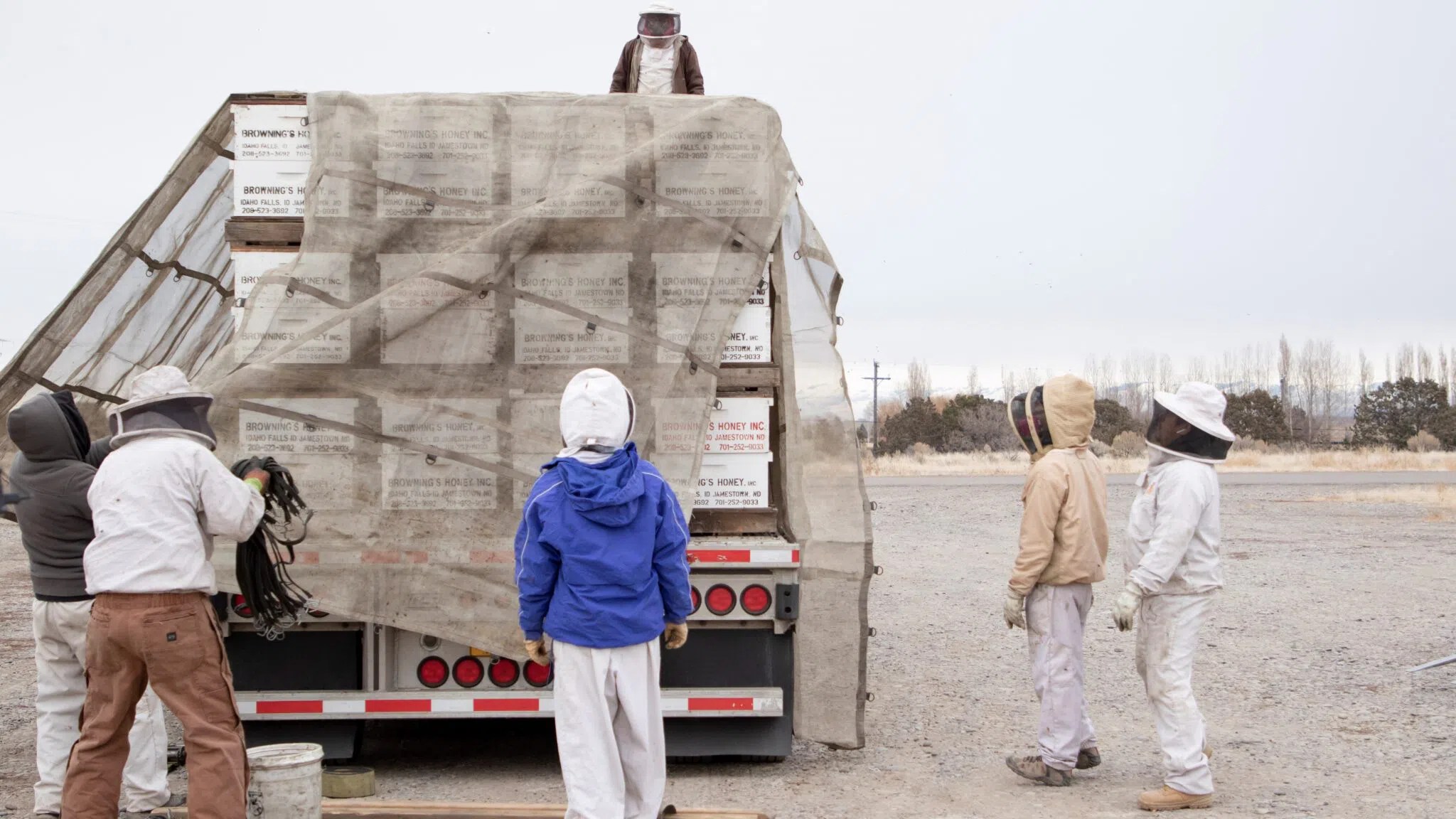
About 75% of crops and one-third of the global food supply rely on pollinators such as honeybees, according to Our World in Data. But farmers have to rely on commercially managed honeybees trucked in from other states to help pollinate certain crops, such as almonds, because there aren’t enough wild bees to do the job. And trucking bees hundreds or thousands of miles is not simple…
Honeybees are disappearing due to shrinking habitats and the growing use of pesticides. When there aren’t enough bees to pollinate fields of crops, companies pay beekeepers to transport their colonies of bees for pollination season.
“The great pollination migration” happens every year in February when the almonds bloom in California.
Pollinating the seemingly endless fields of almond trees in California requires 85% to 90% of all honeybees available to pollinate in the U.S… Bees are trucked into California from across the country…
Earl and Merle Warren are brothers, truck drivers and co-owners of Star’s Ferry Transport, based in Burley, Idaho. They started hauling bees for a local beekeeper in 1990 and moved about 50 loads of approximately 22 million bees each last year for companies such as Browning’s Honey Co.
“This is not like a load of steel or lumber. These are live creatures. This is those beekeepers’ livelihoods, so we do everything possible to keep them alive,” Earl Warren said.
Some beekeepers estimate that every time you move a truck of bees, up to 5% of the queens die… Minimizing stress for bees is critical, so beekeepers rely on experienced truck drivers to navigate difficult situations such as warm weather, few opportunities to stop during the day and inspections…
A fascinating link in the modern food chain: “A day in the life of a honeybee trucker,” from Alyssa Sporrer (@SporrerAlyssa).
* Henry David Thoreau
###
As we ponder pollination, we might spare a thought for a scientist whose very field of study was (and is) made possible by bees, Anders (Andreas) Dahl; he died on this date in 1789. A botanist and student of Carl Linnaeus, he is the inspiration for, the namesake of, the dahlia flower.

“Well, I was born in a small town”*…

… which is, new federal designations now dictate, definitely not an urban area…
Hundreds of urban areas in the U.S. are becoming rural, but it’s not because people are leaving.
It’s just that the U.S. Census Bureau is changing the definition of an urban area. Under the new criteria, more than 1,300 small cities, towns and villages designated urban a decade ago would be considered rural.
That matters because urban and rural areas qualify for different types of federal funding. Some communities worry the change could affect health clinics in rural areas as well as transportation and education funding from federal programs…
Groups like the American Hospital Association say the changes, which are the biggest being made to the definitions in decades, could cause problems for people who need medical care in rural areas…
Different federal programs use different definitions of urban and rural, and some communities qualify for rural funding for some programs and not others. But any changes “will have significant implications for many groups and communities,” said Kenneth Johnson, a senior demographer at the University of New Hampshire who studies rural issues.
“Another likely concern for many rural communities is that if many existing urban areas are redefined as rural, competition for the limited rural funds will increase,” Johnson said…
The difference a designation can make: “100s of US urban areas will become rural with new criteria,” from @AP.
[image above: source]
* John Mellencamp, “Small Town”
###
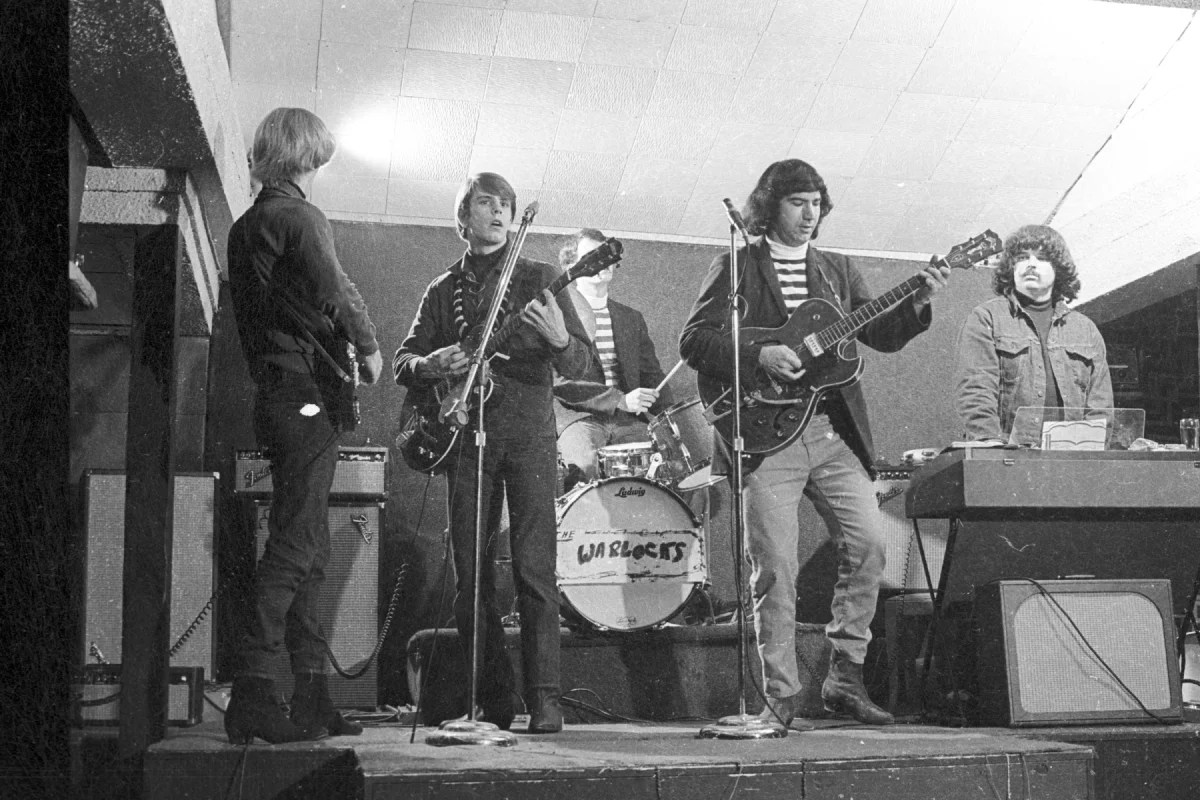
As we contemplate categories and their consequences, we might recall that it was on this date in 1965, at Magoo’s Pizza in (the then small town of) Menlo Park, CA, that Phil Lesh attended a performance of a band then known as The Warlocks. High on acid, he enjoyed it so much that he danced by himself in front of the bandstand. The Warlock’s leader, Jerry Garcia, cornered him and announced, “Hey, man-you’re going to be the bass player in this band”… and so the fundamental line-up of what became The Grateful Dead was set.
“All roads lead to Rome”*…

Spanning one-ninth of the earth’s circumference across three continents, the Roman Empire ruled a quarter of humanity through complex networks of political power, military domination and economic exchange. These extensive connections were sustained by premodern transportation and communication technologies that relied on energy generated by human and animal bodies, winds, and currents.
Conventional maps that represent this world as it appears from space signally fail to capture the severe environmental constraints that governed the flows of people, goods and information. Cost, rather than distance, is the principal determinant of connectivity…
ORBIS: The Stanford Geospatial Network Model of the Roman World reconstructs the time cost and financial expense associated with a wide range of different types of travel in antiquity. The model is based on a simplified version of the giant network of cities, roads, rivers and sea lanes that framed movement across the Roman Empire. It broadly reflects conditions around 200 CE but also covers a few sites and roads created in late antiquity…
For the first time, ORBIS allows us to express Roman communication costs in terms of both time and expense. By simulating movement along the principal routes of the Roman road network, the main navigable rivers, and hundreds of sea routes in the Mediterranean, Black Sea and coastal Atlantic, this interactive model reconstructs the duration and financial cost of travel in antiquity.
Taking account of seasonal variation and accommodating a wide range of modes and means of transport, ORBIS reveals the true shape of the Roman world and provides a unique resource for our understanding of premodern history.
Ancient transportation and travel: “ORBIS: The Stanford Geospatial Network Model of the Roman World.”
* The proverb “All roads lead to Rome” derives from medieval Latin. It was first recorded in writing in 1175 by Alain de Lille, a French theologian and poet, whose Liber Parabolarum renders it as ‘mille viae ducunt homines per saecula Romam’ (a thousand roads lead men forever to Rome)
###
As we plot our paths, we might recall that it was on this date in 1937 that Sylvan Goldman introduced the first shopping cart in his Humpty Dumpty grocery store in Oklahoma City.

You must be logged in to post a comment.