Posts Tagged ‘maps’
“Celebrity is the chastisement of merit and the punishment of talent”*…

A People Map of the US, where city names are replaced by their most Wikipedia’ed resident: people born in, lived in, or connected to a place…
From our friends at The Pudding, a chart of our crazes– zoomable to reveal much more detail: “A People Map of the US.”
* Emily Dickinson
###
As we obsess on obsession, we might recall that it was on this date in 2009 that Kodak ceded the victory of digital photography and announced that it would discontinue the production and sale of Kodachrome print and slide film, a repository of “precious memories” since 1935.

“Few things are more enjoyable than lingering over the atlas and plotting a trip”*…

I’m excited to finally share a new design project this week! Over the past year and a half I’ve been working on a collection of ten maps on planets, moons, and outer space. To name a few, I’ve made an animated map of the seasons on Earth, a map of Mars geology, and a map of everything in the solar system bigger than 10km…
Data visualizer extraordinaire Eleanor Lutz has announced “An Atlas of Space.”
Follow her progress on her blog Tabletop Whale, or on Twitter or Tumblr.
[TotH to Kottke]
###
As we see stars, we might spare a thought for Daniel Kirkwood; he died on this date in 1895. Kirkwood’s most significant contribution came from his study of asteroid orbits. When arranging the then-growing number of discovered asteroids by their distance from the Sun, he noted several gaps, now named Kirkwood gaps in his honor, and associated these gaps with orbital resonances with the orbit of Jupiter. Further, Kirkwood also suggested a similar dynamic was responsible for Cassini Division in Saturn’s rings, as the result of a resonance with one of Saturn’s moons. In the same paper, he was the first to correctly posit that the material in meteor showers is cometary debris.
Kirkwood also identified a pattern relating the distances of the planets to their rotation periods, which was called Kirkwood’s Law. This discovery earned Kirkwood an international reputation among astronomers; he was dubbed “the American Kepler” by Sears Cook Walker, who claimed that Kirkwood’s Law proved the widely held Solar Nebula Theory. (In the event, the “Law” has since become discredited as new measurements of planetary rotation periods have shown that the pattern doesn’t hold.)

“The map? I will first make it.”*…

Nautical map of the world by Nicolo di Caverio, 1506
From the fifteenth to the eighteenth century, European powers sent voyagers to lands farther and farther away from the continent in an expansionist period we now call the Age of Exploration. These journeys were propelled by religious fervor and fierce colonial sentiment—and an overall desire for new trade routes. They would not have been possible without the rise of modern cartography. While geographically accurate maps had existed before, the Age of Exploration saw the emergence of a sustained tradition of topographic surveying. Maps were being made specifically to guide travelers. Technology progressed quickly through the centuries, helping explorers and traders find their way to new imperial outposts—at least sometimes. On other occasions, hiccups in cartographic reasoning led their users even farther astray…
How cartography made early modern global trade possible: “First you make the maps.”
* Voss
###
As we find our way, we might recall that it was on this date in 1578– the same day that King Henry III laid the first stone of the Pont Neuf (“New Bridge”), the oldest remaining bridge in Paris– that the Catacombs of Rome were (re-)discovered. Underground burial sites in use mostly in the 2nd and 3rd centuries AD, they were decorated with both iconographic and stylistic paintings and mosaics. After their rediscovery, it took several decades to explore and map them; indeed, new discoveries have been made as recently as the 1950s.

Eucharistic fresco in the Catacombs [source]
“The afternoon knows what the morning never suspected”*…

Change in population aged 65 and older, 2010-2023. [Screenshot: ESRI]
We’re all getting older. It’s the one thing that every single person alive right now has in common. But we’re also getting older as a population, with Americans both living longer and having fewer children. Census projections show a major demographic shift already underway and accelerating in the years to come.
At the same time, populations are not aging evenly, and issues related to aging will impact individual communities in vastly different ways, boosting economic opportunity in some areas while putting a strain on social services in others.
For instance, real estate developers that invest in progressive senior housing projects now could benefit down the road as demand for modern facilities that cater to active seniors grows. Similarly, American tech companies will see opportunity in developing innovative high-tech solutions for senior care, such as health-monitoring devices, ride-share services aimed at seniors, and care-bots. (Take a look at how Japan has embraced high-tech solutions for its aging population for more on how that might play out in the United States.)
On the flip side, social safety nets are likely to face increasing financial challenges with the continued retirement of America’s Baby Boomers, the youngest of whom will reach 67 by 2031. As that happens, rural counties—where people on average rely on Social Security as a larger portion of their overall income—may disproportionately feel the economic effects of aging.
One way to sort out who will be most impacted by aging is to look at age demographics across the country and how they will change over time…
America is aging, but not evenly: “7 maps that tell the incredible story of aging in America.”
See also this essay by Don Norman, the 83 year-old dean of user-centered design (author of The Design of Everyday Things and a former VP at Apple): “I wrote the book on user-friendly design. What I see today horrifies me.”
* Robert Frost
###
As we stand up to senescence, we might recall that it was on this date in 1965 that Peter Townsend wrote “My Generation”– inspired by the Queen Mother, who’d had his 1935 Packard hearse towed off a street in Belgravia because she was offended by the sight of it during her daily drive through the neighborhood. The song was released as a single later that year and became first a hit, then an anthem.
“We don’t just borrow words; on occasion, English has pursued other languages down alleyways to beat them unconscious and rifle their pockets for new vocabulary”*…

In the early history of international trade, when exotic goods traveled to new regions, their native names sometimes hitchhiked along with them.
Naturally, the Germans have a term – Wanderwörter – for these extraordinary loanwords that journey around the globe, mutating subtly along the way…
See the map above in larger format, and learn more about each of the examples it illustrates at: “Mapping the Spread of Words Along Trade Routes.” [sourced from Lapham’s Quarterly]
* James Nicoll
###
As we ponder the provenance of our produce, we might recall that it was on this date 1397 that Geoffrey Chaucer “told” The Canterbury Tales for the first time at the court of Richard II.
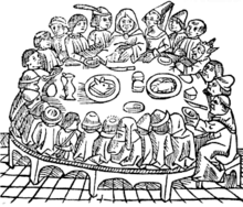
A woodcut from William Caxton‘s second edition of The Canterbury Tales, printed in 1483
You must be logged in to post a comment.